
Make a donation
Gear up for your next adventure:
As an Amazon Associate, this site earns from qualifying purchases at no extra cost to you.
Vikos topographic map
Click on the map to display elevation.
Make a donation
Gear up for your next adventure:
As an Amazon Associate, this site earns from qualifying purchases at no extra cost to you.
About this map
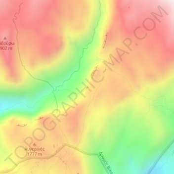
Name: Vikos topographic map, elevation, terrain.
Average elevation: 5,515 ft
Minimum elevation: 4,088 ft
Maximum elevation: 6,621 ft
Make a donation
Gear up for your next adventure:
As an Amazon Associate, this site earns from qualifying purchases at no extra cost to you.
Other topographic maps
Click on a map to view its topography, its elevation and its terrain.
Πανεπιστημιούπολη
Greece > Epirus and Western Macedonia > Ioannina Regional Unit > Ioannina > Νεοχωρόπουλο
Average elevation: 1,765 ft
Make a donation
Gear up for your next adventure:
As an Amazon Associate, this site earns from qualifying purchases at no extra cost to you.
Κατσικάς
Greece > Epirus and Western Macedonia > Ioannina Regional Unit > Pamvotida Municipal Unit
Average elevation: 1,621 ft
Ioannina
Greece > Epirus and Western Macedonia > Ioannina Regional Unit
According to the 2021 census, the city population was 64,896 while the municipality had 113,978 inhabitants. It lies at an elevation of approximately 500 metres (1,640 feet) above sea level, on the western shore of Lake Pamvotis (Παμβώτις). Ioannina is located 410 km (255 mi) northwest of Athens, 260…
Average elevation: 2,375 ft
Φαράγγι Βίκου
Greece > Epirus and Western Macedonia > Ioannina Regional Unit
Average elevation: 3,802 ft
Make a donation
Gear up for your next adventure:
As an Amazon Associate, this site earns from qualifying purchases at no extra cost to you.
Φαράγγι Βίκου
Greece > Epirus and Western Macedonia > Ioannina Regional Unit
Average elevation: 3,576 ft
Make a donation
Gear up for your next adventure:
As an Amazon Associate, this site earns from qualifying purchases at no extra cost to you.
Κήποι
Greece > Epirus and Western Macedonia > Ioannina Regional Unit
Kipoi (Greek: Κήποι, before 1928: Μπάγια – Bagia) is a village in the region of Zagori. It belongs to the municipal unit of Tymfi, Ioannina regional unit, Greece. The Greek name derives from the many gardens in the surrounding areas (Greek Κήποι=Gardens). The name "Bagia" is Slavic and means…
Average elevation: 2,858 ft
North Tzoumerka Municipality
Greece > Epirus and Western Macedonia > Ioannina Regional Unit
Average elevation: 3,248 ft
Παρακάλαμος
Greece > Epirus and Western Macedonia > Ioannina Regional Unit
Average elevation: 1,365 ft
Μικρό Πάπιγκο
Greece > Epirus and Western Macedonia > Ioannina Regional Unit
Average elevation: 4,072 ft
Make a donation
Gear up for your next adventure:
As an Amazon Associate, this site earns from qualifying purchases at no extra cost to you.