Geolocate

Winthrop topographic map

Click on the map to display elevation.

About this map

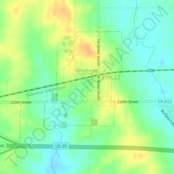
Name: Winthrop topographic map, elevation, terrain.

Location: Winthrop, Buchanan County, Iowa, United States (42.46210 -91.75631 42.47935 -91.72697)

Average elevation: 1,033 ft

Minimum elevation: 988 ft

Maximum elevation: 1,089 ft

Buchanan County trails, hiking, mountain biking, running and outdoor activities

Other topographic maps

Click on a map to view its topography, its elevation and its terrain.

Littleton

United States > Iowa > Buchanan County

Average elevation: 951 ft

Gear up for your next adventure:

🏔️Mountain Trail Maps - High‑detail maps for popular peaks
🧯Portable Fire Pit - Compact fire pit for camping spots
🪶LED Camping Lantern - Bright lantern for camp lighting
🎒Waterproof Dry Bags - Keep your electronics and maps dry inside your pack
🪶Compact Camp Shovel - Folding shovel for campsite tasks

As an Amazon Associate, this site earns from qualifying purchases at no extra cost to you.