
Red Mountain topographic map
Click on the map to display elevation.
About this map
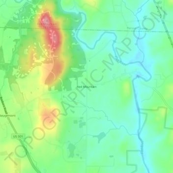
Name: Red Mountain topographic map, elevation, terrain.
Average elevation: 515 ft
Minimum elevation: 387 ft
Maximum elevation: 781 ft
Durham County trails, hiking, mountain biking, running and outdoor activities
Other topographic maps
Click on a map to view its topography, its elevation and its terrain.
Falls Lake
United States > North Carolina > Durham County
Work on the dam that holds the lake began in 1978 and was completed in 1981. Prior to its construction flooding of the Neuse River caused extensive damage to public and private properties including roadways, railroads, industrial sites and farmlands. The U.S. Army Corps of Engineers constructed and manages the…
Average elevation: 331 ft