Geolocate

Ardamadane topographic map

Click on the map to display elevation.

About this map

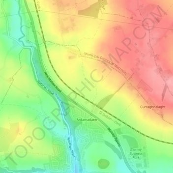
Name: Ardamadane topographic map, elevation, terrain.

Location: Ardamadane, Blarney ED, Cork, County Cork, Munster, Ireland (51.94117 -8.57349 51.95448 -8.55736)

Average elevation: 302 ft

Minimum elevation: 118 ft

Maximum elevation: 459 ft

Other topographic maps

Click on a map to view its topography, its elevation and its terrain.

Cork

Ireland > County Cork > Cork

Average elevation: 308 ft

Tramore Valley Park

Ireland > County Cork > Cork

Average elevation: 92 ft

Upper Glanmire Bridge

Ireland > County Cork > Cork

Average elevation: 295 ft

Fair Hill

Ireland > County Cork > Cork

Average elevation: 223 ft

Ballincollig Regional Park

Ireland > County Cork > Cork

Average elevation: 180 ft

Ballincollig

Ireland > County Cork > Cork

Average elevation: 203 ft

Beaumont Park

Ireland > County Cork > Cork

Average elevation: 39 ft

River Lee (North Channel)

Ireland > County Cork > Cork

Average elevation: 161 ft

Kerry Pike

Ireland > County Cork > Cork

Average elevation: 180 ft

Stone Beach

Ireland > County Cork > Cork

Average elevation: 154 ft

River Lee (North Channel)

Ireland > County Cork > Cork

Average elevation: 105 ft

Gear up for your next adventure:

🚪Portable Camp Chair - Foldable chair for comfort at camp
Camping Coffee Makers - Enjoy premium coffee at the summit or campsite
🔌USB Car Charger - Car charger for on‑the‑go power needs
🔋Solar Power Banks - Keep your GPS and phone charged in remote wilderness areas
💧Water Purification System - Clean water on the trail with reliable purifiers

As an Amazon Associate, this site earns from qualifying purchases at no extra cost to you.