
Stockbridge topographic map
Click on the map to display elevation.
About this map
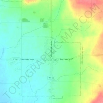
Name: Stockbridge topographic map, elevation, terrain.
Location: Stockbridge, Calumet County, Wisconsin, 53088, United States (44.05820 -88.33032 44.09035 -88.28639)
Average elevation: 856 ft
Minimum elevation: 771 ft
Maximum elevation: 1,014 ft
Calumet County trails, hiking, mountain biking, running and outdoor activities
Other topographic maps
Click on a map to view its topography, its elevation and its terrain.
Calumet County Park
United States > Wisconsin > Calumet County > Rockaway Beach
Average elevation: 843 ft