Geolocate

Forest Junction topographic map

Click on the map to display elevation.

About this map

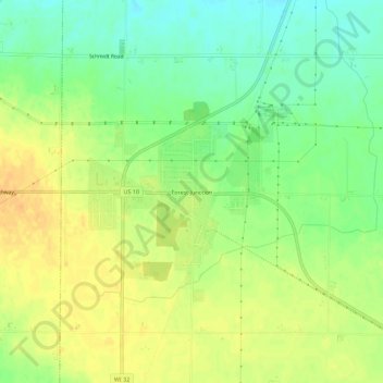
Name: Forest Junction topographic map, elevation, terrain.

Location: Forest Junction, Town of Brillion, Calumet County, Wisconsin, 54123, United States (44.19249 -88.16427 44.23249 -88.12427)

Average elevation: 827 ft

Minimum elevation: 768 ft

Maximum elevation: 876 ft

Calumet County trails, hiking, mountain biking, running and outdoor activities

Other topographic maps

Click on a map to view its topography, its elevation and its terrain.

Hilbert

United States > Wisconsin > Calumet County

Average elevation: 846 ft

Chilton

United States > Wisconsin > Calumet County

Average elevation: 902 ft

Potter

United States > Wisconsin > Calumet County

Average elevation: 827 ft

Sherwood

United States > Wisconsin > Calumet County

Average elevation: 869 ft

Stockbridge

United States > Wisconsin > Calumet County

Average elevation: 856 ft

Gear up for your next adventure:

🕶️GPS Smartphone Mount - Secure mount for phone navigation
🏕️Family Camping Gear - Essentials for group camping trips
🎒Day Hiking Backpack - Lightweight backpack perfect for day trips and outdoor adventures
🛌Ultralight Sleeping Bags - Compact down bags for cold nights in the wilderness
🎒Outdoor Daypacks - Lightweight backpacks designed for carrying maps and essential gear

As an Amazon Associate, this site earns from qualifying purchases at no extra cost to you.