
Make a donation
Gear up for your next adventure:
As an Amazon Associate, this site earns from qualifying purchases at no extra cost to you.
Breitenstein topographic map
Click on the map to display elevation.
Make a donation
Gear up for your next adventure:
As an Amazon Associate, this site earns from qualifying purchases at no extra cost to you.
Breitenstein
Breitenstein liegt im Unterharz im Naturpark Harz/Sachsen-Anhalt rund 5 km (Luftlinie) nördlich von Stolberg. Hindurch führt die Harzschützenstraße, die jahrhundertelang die Grenze von Thüringen und Sachsen bildete und als Landesstraße 263 nordnordwestwärts nach Friedrichshöhe und dann weiter zur nahen Bundesstraße 242 im Tal der Selke verläuft. Der Selke-Zufluss Katzsohlbach fließt durch das Dorf.
Make a donation
Gear up for your next adventure:
As an Amazon Associate, this site earns from qualifying purchases at no extra cost to you.
About this map
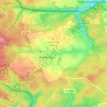
Name: Breitenstein topographic map, elevation, terrain.
Average elevation: 1,588 ft
Minimum elevation: 1,329 ft
Maximum elevation: 1,847 ft
Make a donation
Gear up for your next adventure:
As an Amazon Associate, this site earns from qualifying purchases at no extra cost to you.
Other topographic maps
Click on a map to view its topography, its elevation and its terrain.
Make a donation
Gear up for your next adventure:
As an Amazon Associate, this site earns from qualifying purchases at no extra cost to you.
Wolferode
Deutschland > Sachsen-Anhalt > Mansfeld-Südharz > Lutherstadt Eisleben > Wolferode
Average elevation: 755 ft
Make a donation
Gear up for your next adventure:
As an Amazon Associate, this site earns from qualifying purchases at no extra cost to you.
Rohnetal
Deutschland > Sachsen-Anhalt > Mansfeld-Südharz > Allstedt > Wolferstedt
Average elevation: 564 ft
Make a donation
Gear up for your next adventure:
As an Amazon Associate, this site earns from qualifying purchases at no extra cost to you.
Großer Auerberg
Deutschland > Sachsen-Anhalt > Mansfeld-Südharz
Der Große Auerberg im Harz ist ein 580,4 m ü. NHN hoher Berg bei Stolberg im Gemeindegebiet von Südharz im Landkreis Mansfeld-Südharz in Sachsen-Anhalt. Es handelt sich um einen Doppelgipfel von 580,4 m (Großer Auerberg) und 580,3 m (Josephshöhe) Höhe, die etwa 470 m auseinander liegen.
Average elevation: 1,572 ft
Make a donation
Gear up for your next adventure:
As an Amazon Associate, this site earns from qualifying purchases at no extra cost to you.
Popperode
Deutschland > Sachsen-Anhalt > Mansfeld-Südharz > Sangerhausen > Popperode
Average elevation: 1,076 ft
Hedersleben (b. Eisleben)
Deutschland > Sachsen-Anhalt > Mansfeld-Südharz > Lutherstadt Eisleben > Hedersleben (b. Eisleben)
Average elevation: 659 ft
Sittendorf
Deutschland > Sachsen-Anhalt > Mansfeld-Südharz > Kelbra (Kyffhäuser)
Average elevation: 666 ft