
Make a donation
Gear up for your next adventure:
As an Amazon Associate, this site earns from qualifying purchases at no extra cost to you.
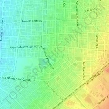
Nahuelbuta topographic map
Click on the map to display elevation.
Make a donation
Gear up for your next adventure:
As an Amazon Associate, this site earns from qualifying purchases at no extra cost to you.
About this map
Name: Nahuelbuta topographic map, elevation, terrain.
Average elevation: 1,545 ft
Minimum elevation: 1,490 ft
Maximum elevation: 1,611 ft
Make a donation
Gear up for your next adventure:
As an Amazon Associate, this site earns from qualifying purchases at no extra cost to you.
Other topographic maps
Click on a map to view its topography, its elevation and its terrain.
Santiago
Chile > Santiago Metropolitan Region > Provincia de Santiago
The city lies in the center of the Santiago Basin, a large bowl-shaped valley consisting of broad and fertile lands surrounded by mountains. The city has a varying elevation, gradually increasing from 400 m (1,312 ft) in the western areas to more than 700 m (2,297 ft) in the eastern areas. Santiago's…
Average elevation: 2,369 ft
Santiago
Chile > Santiago Metropolitan Region > Provincia de Santiago
The city lies in the center of the Santiago Basin, a large bowl-shaped valley consisting of broad and fertile lands surrounded by mountains. The city has a varying elevation, gradually increasing from 400 m (1,312 ft) in the western areas to more than 700 m (2,297 ft) in the eastern areas. Santiago's…
Average elevation: 2,375 ft
Santiago
Chile > Santiago Metropolitan Region > Provincia de Santiago
The city lies in the center of the Santiago Basin, a large bowl-shaped valley consisting of broad and fertile lands surrounded by mountains. The city has a varying elevation, gradually increasing from 400 m (1,312 ft) in the western areas to more than 700 m (2,297 ft) in the eastern areas. Santiago's…
Average elevation: 1,814 ft
Make a donation
Gear up for your next adventure:
As an Amazon Associate, this site earns from qualifying purchases at no extra cost to you.
Mapocho river
Chile > Santiago Metropolitan Region > Provincia de Santiago
Average elevation: 1,932 ft
Santiago
Chile > Santiago Metropolitan Region > Provincia de Santiago
The city lies in the center of the Santiago Basin, a large bowl-shaped valley consisting of broad and fertile lands surrounded by mountains. The city has a varying elevation, gradually increasing from 400 meters (1,300 feet) in the western areas to more than 700 m (2,297 ft) in the eastern areas. Santiago's…
Average elevation: 2,369 ft
Santiago
Chile > Santiago Metropolitan Region > Provincia de Santiago
The city lies in the center of the Santiago Basin, a large bowl-shaped valley consisting of broad and fertile lands surrounded by mountains. The city has a varying elevation, gradually increasing from 400 m (1,312 ft) in the western areas to more than 700 m (2,297 ft) in the eastern areas. Santiago's…
Average elevation: 2,375 ft
Make a donation
Gear up for your next adventure:
As an Amazon Associate, this site earns from qualifying purchases at no extra cost to you.
Recoleta
Chile > Santiago Metropolitan Region > Provincia de Santiago > Santiago
Average elevation: 1,824 ft
Santiago
Chile > Santiago Metropolitan Region > Provincia de Santiago
The city lies in the center of the Santiago Basin, a large bowl-shaped valley consisting of broad and fertile lands surrounded by mountains. The city has a varying elevation, gradually increasing from 400 m (1,312 ft) in the western areas to more than 700 m (2,297 ft) in the eastern areas. Santiago's…
Average elevation: 1,814 ft
Make a donation
Gear up for your next adventure:
As an Amazon Associate, this site earns from qualifying purchases at no extra cost to you.
Santiago
Chile > Santiago Metropolitan Region > Provincia de Santiago
The city lies in the center of the Santiago Basin, a large bowl-shaped valley consisting of broad and fertile lands surrounded by mountains. The city has a varying elevation, gradually increasing from 400 m (1,312 ft) in the western areas to more than 700 m (2,297 ft) in the eastern areas. Santiago's…
Average elevation: 1,814 ft
Cerro San Cristóbal
Chile > Santiago Metropolitan Region > Provincia de Santiago
The summit of Cerro San Cristóbal can be reached by foot (about a 45-minute walk, involving a 300m change in elevation), by car via the road joining the Santiago Metropolitan Park, by the Funicular de Santiago (the base of which sits next to the Zoo at the North end of Pio Nono in Barrio Bellavista), or by a…
Average elevation: 2,018 ft
Valle Nevado
Chile > Santiago Metropolitan Region > Provincia de Santiago > Lo Barnechea
Due to its elevation, Valle Nevado has a subalpine climate (Dfc, according to the Köppen climate classification, bordering on Dfb and ET), with drier summers and humid winters, with an average annual precipitation of 1,042 mm (41 in). Summers are chilly and dry, while winters are cold and snowy.
Average elevation: 9,222 ft
Make a donation
Gear up for your next adventure:
As an Amazon Associate, this site earns from qualifying purchases at no extra cost to you.
La Reina
Chile > Santiago Metropolitan Region > Provincia de Santiago > Santiago
Average elevation: 2,536 ft
Santiago
Chile > Santiago Metropolitan Region > Provincia de Santiago
The city lies in the center of the Santiago Basin, a large bowl-shaped valley consisting of broad and fertile lands surrounded by mountains. The city has a varying elevation, gradually increasing from 400 m (1,312 ft) in the western areas to more than 700 m (2,297 ft) in the eastern areas. Santiago's…
Average elevation: 1,814 ft
Lo Barnechea
Chile > Santiago Metropolitan Region > Provincia de Santiago
Its pre-Hispanic inhabitants were called huaicoches (in Mapudungún: waykoche 'people who live in a landslide zone') because of the huaicos or huaycos of the region (in Quechua: wayqu 'stream'). Also called lloclla (in Quechua: lluqlla 'alluvium'), these are violent alluvial floods in which a large amount of…
Average elevation: 7,818 ft
Make a donation
Gear up for your next adventure:
As an Amazon Associate, this site earns from qualifying purchases at no extra cost to you.
Quinta Normal
Chile > Santiago Metropolitan Region > Provincia de Santiago
Average elevation: 1,683 ft
Peñalolén
Chile > Santiago Metropolitan Region > Provincia de Santiago > Santiago
Average elevation: 3,166 ft
Punta Santiago
Chile > Santiago Metropolitan Region > Provincia de Santiago > Lo Barnechea
Average elevation: 15,659 ft
Make a donation
Gear up for your next adventure:
As an Amazon Associate, this site earns from qualifying purchases at no extra cost to you.
La Pintana
Chile > Santiago Metropolitan Region > Provincia de Santiago > La Pintana
Average elevation: 2,051 ft
Conchalí
Chile > Santiago Metropolitan Region > Provincia de Santiago > Conchalí
Average elevation: 1,673 ft
Pedro Aguirre Cerda
Chile > Santiago Metropolitan Region > Provincia de Santiago
Average elevation: 1,736 ft
Make a donation
Gear up for your next adventure:
As an Amazon Associate, this site earns from qualifying purchases at no extra cost to you.