
Conchalí topographic map
Click on the map to display elevation.
About this map
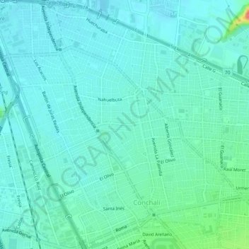
Name: Conchalí topographic map, elevation, terrain.
Average elevation: 1,673 ft
Minimum elevation: 1,634 ft
Maximum elevation: 1,850 ft
Other topographic maps
Click on a map to view its topography, its elevation and its terrain.
Santiago
Chile > Santiago Metropolitan Region > Provincia de Santiago
The city lies in the center of the Santiago Basin, a large bowl-shaped valley consisting of broad and fertile lands surrounded by mountains. The city has a varying elevation, gradually increasing from 400 m (1,312 ft) in the western areas to more than 700 m (2,297 ft) in the eastern areas. Santiago's…
Average elevation: 2,369 ft
Farellones
Chile > Santiago Metropolitan Region > Provincia de Santiago
Located in the commune of Lo Barnechea, 36 km from Santiago at an altitude of 2,340 meters above sea level (7,874 feet), Farellones has a health centre, a school, and about 200 houses. The houses and cabins are made of wood, giving the village its characteristic look.
Average elevation: 7,359 ft
Santiago
Chile > Santiago Metropolitan Region > Provincia de Santiago
The city lies in the center of the Santiago Basin, a large bowl-shaped valley consisting of broad and fertile lands surrounded by mountains. The city has a varying elevation, gradually increasing from 400 m (1,312 ft) in the western areas to more than 700 m (2,297 ft) in the eastern areas. Santiago's…
Average elevation: 2,369 ft
Santiago
Chile > Santiago Metropolitan Region > Provincia de Santiago
The city lies in the center of the Santiago Basin, a large bowl-shaped valley consisting of broad and fertile lands surrounded by mountains. The city has a varying elevation, gradually increasing from 400 meters (1,300 feet) in the western areas to more than 700 m (2,297 ft) in the eastern areas. Santiago's…
Average elevation: 2,369 ft
Santiago
Chile > Santiago Metropolitan Region > Provincia de Santiago
The city lies in the center of the Santiago Basin, a large bowl-shaped valley consisting of broad and fertile lands surrounded by mountains. The city has a varying elevation, gradually increasing from 400 m (1,312 ft) in the western areas to more than 700 m (2,297 ft) in the eastern areas. Santiago's…
Average elevation: 2,375 ft
Valle Nevado
Chile > Santiago Metropolitan Region > Provincia de Santiago > Lo Barnechea
Due to its elevation, Valle Nevado has a subalpine climate (Dfc, according to the Köppen climate classification, bordering on Dfb and ET), with drier summers and humid winters, with an average annual precipitation of 1,042 mm (41 in). Summers are chilly and dry, while winters are cold and snowy.
Average elevation: 9,222 ft
Parque Titanium
Chile > Santiago Metropolitan Region > Provincia de Santiago
Average elevation: 2,113 ft
Parque Quinta Normal
Chile > Santiago Metropolitan Region > Provincia de Santiago > Santiago
Average elevation: 1,726 ft
Cerro San Cristóbal
Chile > Santiago Metropolitan Region > Provincia de Santiago
The summit of Cerro San Cristóbal can be reached by foot (about a 45-minute walk, involving a 300m change in elevation), by car via the road joining the Santiago Metropolitan Park, by the Funicular de Santiago (the base of which sits next to the Zoo at the North end of Pio Nono in Barrio Bellavista), or by a…
Average elevation: 2,018 ft