Geolocate

Fords Prairie topographic map

Click on the map to display elevation.

About this map

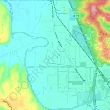
Name: Fords Prairie topographic map, elevation, terrain.

Location: Fords Prairie, Lewis County, Washington, United States (46.71673 -123.03305 46.76458 -122.97546)

Average elevation: 220 ft

Minimum elevation: 121 ft

Maximum elevation: 577 ft

Lewis County trails, hiking, mountain biking, running and outdoor activities

Other topographic maps

Click on a map to view its topography, its elevation and its terrain.

Bremer

United States > Washington > Lewis County

Average elevation: 1,411 ft

Pompey Peak

United States > Washington > Lewis County

Average elevation: 3,793 ft

Packwood

United States > Washington > Lewis County

Average elevation: 1,243 ft

Mineral

United States > Washington > Lewis County > Mineral

Average elevation: 1,578 ft

Onalaska

United States > Washington > Lewis County

Average elevation: 558 ft

Adna

United States > Washington > Lewis County

Average elevation: 269 ft

Walupt Creek Falls

United States > Washington > Lewis County

Average elevation: 3,799 ft

Narada Falls

United States > Washington > Lewis County

Average elevation: 4,738 ft

Vader

United States > Washington > Lewis County

Average elevation: 243 ft

Glenoma

United States > Washington > Lewis County

Average elevation: 1,161 ft

Chimney Rock

United States > Washington > Lewis County

Average elevation: 5,226 ft

Gear up for your next adventure:

🔋Rechargeable Batteries - Power up your outdoor devices
🧭GPS Watch Accessories - Bands and chargers for GPS watches
🧭Pro Hiking Compasses - High-accuracy liquid-filled compasses for topographic orientation
👖Convertible Hiking Pants - Versatile zip-off pants for changing altitudes and temperatures
🎒Waterproof Dry Bags - Keep your electronics and maps dry inside your pack

As an Amazon Associate, this site earns from qualifying purchases at no extra cost to you.