
Alpine Tarn topographic map
Click on the map to display elevation.
About this map
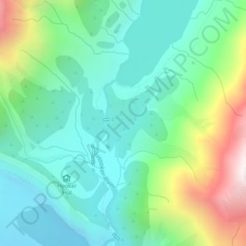
Name: Alpine Tarn topographic map, elevation, terrain.
Location: Alpine Tarn, Mackenzie District, Canterbury, New Zealand (-43.69323 170.10105 -43.69302 170.10128)
Average elevation: 3,570 ft
Minimum elevation: 2,490 ft
Maximum elevation: 6,365 ft
Other topographic maps
Click on a map to view its topography, its elevation and its terrain.
Lake Pūkaki
New Zealand > Canterbury > Mackenzie District
The glacial feed to the lakes gives them a distinctive blue colour, created by glacial flour, the extremely finely ground rock particles from the glaciers. Lake Pukaki covers an area of 178.7 km2 (69.0 sq mi), and the surface elevation of the lake normally ranges from 518.2 to 532 metres (1,700 to 1,745 ft)…
Average elevation: 2,907 ft