Geolocate

Detmold topographic map

Click on the map to display elevation.

About this map

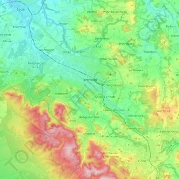
Name: Detmold topographic map, elevation, terrain.

Location: Detmold, Kreis Lippe, North Rhine-Westphalia, Germany (51.85873 8.76308 51.99827 8.98958)

Average elevation: 663 ft

Minimum elevation: 312 ft

Maximum elevation: 1,401 ft

Other topographic maps

Click on a map to view its topography, its elevation and its terrain.

Horn

Germany > North Rhine-Westphalia > Kreis Lippe

Average elevation: 837 ft

Gear up for your next adventure:

🧺Microfiber Travel Towels - Compact and fast-drying towels for trail use
🪶Trail Camera - Capture wildlife on your hikes
🏥Hiking First Aid Kits - Comprehensive medical kits for remote trail injuries
💧Water Filtration Bottles - Safely drink from streams and lakes while exploring
🗃️Trail First Aid Kit - Essential kit for outdoor injuries and emergencies

As an Amazon Associate, this site earns from qualifying purchases at no extra cost to you.