
Thank you for supporting this site ❤️
Make a donation
Make a donation
Gear up for your next adventure:
As an Amazon Associate, this site earns from qualifying purchases at no extra cost to you.
Ikutha topographic map
Click on the map to display elevation.
Thank you for supporting this site ❤️
Make a donation
Make a donation
Gear up for your next adventure:
As an Amazon Associate, this site earns from qualifying purchases at no extra cost to you.
About this map
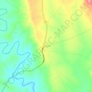
Name: Ikutha topographic map, elevation, terrain.
Location: Ikutha, Kitui South, Kitui County, Eastern, Kenya (-2.08503 38.15930 -2.04503 38.19930)
Average elevation: 2,283 ft
Minimum elevation: 2,136 ft
Maximum elevation: 2,516 ft
Thank you for supporting this site ❤️
Make a donation
Make a donation
Gear up for your next adventure:
As an Amazon Associate, this site earns from qualifying purchases at no extra cost to you.