
Thank you for supporting this site ❤️
Make a donation
Make a donation
Gear up for your next adventure:
As an Amazon Associate, this site earns from qualifying purchases at no extra cost to you.
Nyati topographic map
Click on the map to display elevation.
Thank you for supporting this site ❤️
Make a donation
Make a donation
Gear up for your next adventure:
As an Amazon Associate, this site earns from qualifying purchases at no extra cost to you.
About this map
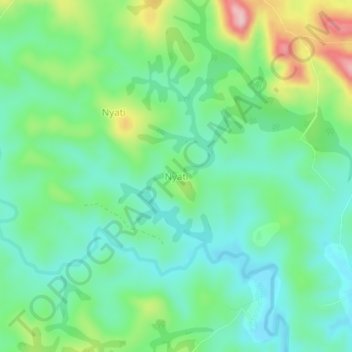
Name: Nyati topographic map, elevation, terrain.
Location: Nyati, Banyo, Mayo-Banyo, Adamawa, Cameroon (6.63188 11.78228 6.67188 11.82228)
Average elevation: 3,835 ft
Minimum elevation: 3,625 ft
Maximum elevation: 4,337 ft
Thank you for supporting this site ❤️
Make a donation
Make a donation
Gear up for your next adventure:
As an Amazon Associate, this site earns from qualifying purchases at no extra cost to you.