
Make a donation
Gear up for your next adventure:
As an Amazon Associate, this site earns from qualifying purchases at no extra cost to you.
Norquay topographic map
Click on the map to display elevation.
Make a donation
Gear up for your next adventure:
As an Amazon Associate, this site earns from qualifying purchases at no extra cost to you.
About this map
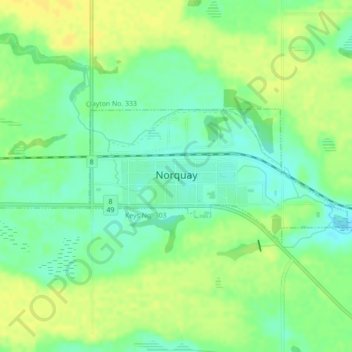
Name: Norquay topographic map, elevation, terrain.
Location: Norquay, Division No. 9, Saskatchewan, S0A 2V0, Canada (51.87897 -102.10160 51.88927 -102.06950)
Average elevation: 1,624 ft
Minimum elevation: 1,585 ft
Maximum elevation: 1,654 ft
Make a donation
Gear up for your next adventure:
As an Amazon Associate, this site earns from qualifying purchases at no extra cost to you.
Other topographic maps
Click on a map to view its topography, its elevation and its terrain.
Good Spirit Lake
Canada > Saskatchewan > Division No. 9 > Good Lake No. 274
Average elevation: 1,578 ft
Make a donation
Gear up for your next adventure:
As an Amazon Associate, this site earns from qualifying purchases at no extra cost to you.