
Croughton topographic map
Click on the map to display elevation.
About this map
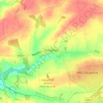
Name: Croughton topographic map, elevation, terrain.
Location: Croughton, West Northamptonshire, England, United Kingdom (51.97727 -1.22311 52.01776 -1.17987)
Average elevation: 417 ft
Minimum elevation: 302 ft
Maximum elevation: 489 ft
Other topographic maps
Click on a map to view its topography, its elevation and its terrain.
Lower Thorpe
United Kingdom > England > West Northamptonshire > Thorpe Mandeville
Average elevation: 505 ft
Upton Country Park
United Kingdom > England > West Northamptonshire > Harpole
Average elevation: 246 ft
Abington Park
United Kingdom > England > West Northamptonshire > Northampton
Average elevation: 279 ft
Ravensthorpe Reservoir
United Kingdom > England > West Northamptonshire > Coton
Average elevation: 430 ft
Courteenhall
United Kingdom > England > West Northamptonshire > Courteenhall
Average elevation: 351 ft