Geolocate

Puxley topographic map

Click on the map to display elevation.

About this map

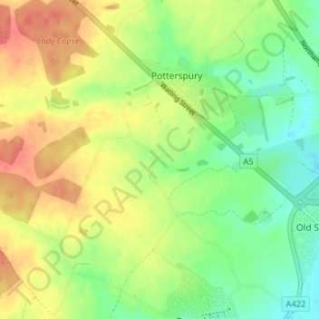
Name: Puxley topographic map, elevation, terrain.

Location: Puxley, Deanshanger, West Northamptonshire, England, NN12 7QS, United Kingdom (52.05188 -0.91864 52.09188 -0.87864)

Average elevation: 312 ft

Minimum elevation: 223 ft

Maximum elevation: 413 ft

Other topographic maps

Click on a map to view its topography, its elevation and its terrain.

Daventry

United Kingdom > England > West Northamptonshire

According to local folklore Daventry had Danish (Viking) origins, this was partly due to the old pronunciation of Daventry as Daintry, which was interpreted as "Dane Tree", however in more modern interpretation the town's name is thought likelier to be Anglo-Saxon in origin: "Dafa's tree" (Dafa being a…

Average elevation: 486 ft

Northampton

United Kingdom > England > West Northamptonshire > Northampton

As with the rest of the British Isles, Northampton experiences a maritime climate with cool summers and mild winters. The official Met Office weather station for Northampton is the Moulton Park Weather Station at the University of Northampton. Situated at an elevation of around 130 m (427 ft) above sea level…

Average elevation: 292 ft

Northampton

United Kingdom > England > West Northamptonshire

As with the rest of the British Isles, Northampton experiences an oceanic climate with cool summers and mild winters. The official Met Office weather station for Northampton is the Moulton Park Weather Station at the University of Northampton. Situated at an elevation of around 130 m (427 ft) above sea level…

Average elevation: 292 ft

Spratton

United Kingdom > England > West Northamptonshire

Average elevation: 322 ft

Upton

United Kingdom > England > West Northamptonshire > Upton

Average elevation: 266 ft

Syresham

United Kingdom > England > West Northamptonshire

Average elevation: 453 ft

Elkington

United Kingdom > England > West Northamptonshire

Average elevation: 489 ft

Brackley

United Kingdom > England > West Northamptonshire

Average elevation: 423 ft

Brixworth

United Kingdom > England > West Northamptonshire

Average elevation: 344 ft

Duston

United Kingdom > England > West Northamptonshire > Duston

Average elevation: 318 ft

Croughton

United Kingdom > England > West Northamptonshire

Average elevation: 417 ft

Barby

United Kingdom > England > West Northamptonshire

Average elevation: 374 ft

Kelmarsh

United Kingdom > England > West Northamptonshire

Average elevation: 453 ft

Brockhall

United Kingdom > England > West Northamptonshire

Average elevation: 344 ft

Draughton

United Kingdom > England > West Northamptonshire

Average elevation: 459 ft

Blakesley

United Kingdom > England > West Northamptonshire

Average elevation: 463 ft

Braunston

United Kingdom > England > West Northamptonshire

Average elevation: 420 ft

Thenford

United Kingdom > England > West Northamptonshire

Average elevation: 440 ft

Maidford

United Kingdom > England > West Northamptonshire

Average elevation: 515 ft

Everdon

United Kingdom > England > West Northamptonshire > Everdon

Average elevation: 427 ft

Eydon

United Kingdom > England > West Northamptonshire

Average elevation: 472 ft

Towcester

United Kingdom > England > West Northamptonshire

St. Lawrence's C of E Church, stands in the middle of the town. It has a 12th-century Norman transitional ground plan and foundation, probably laid over a Saxon 10th century stone building. Its ecclesiastical heritage may well relate back to Roman times as St Lawrence was patron saint of the Roman legions. The…

Average elevation: 367 ft

Gayton

United Kingdom > England > West Northamptonshire

Average elevation: 374 ft

Cosgrove

United Kingdom > England > West Northamptonshire

Average elevation: 253 ft

Ashton

United Kingdom > England > West Northamptonshire

Average elevation: 322 ft

Flore

United Kingdom > England > West Northamptonshire

Average elevation: 325 ft

Radstone

United Kingdom > England > West Northamptonshire

Average elevation: 476 ft

Badby

United Kingdom > England > West Northamptonshire

Average elevation: 522 ft

Haselbech

United Kingdom > England > West Northamptonshire

Average elevation: 525 ft

Newbottle

United Kingdom > England > West Northamptonshire

Average elevation: 427 ft

Harpole

United Kingdom > England > West Northamptonshire

Average elevation: 318 ft

Northampton

United Kingdom > England > West Northamptonshire > Northampton

As with the rest of the British Isles, Northampton experiences a maritime climate with cool summers and mild winters. The official Met Office weather station for Northampton is the Moulton Park Weather Station at the University of Northampton. Situated at an elevation of around 130 m (427 ft) above sea level…

Average elevation: 292 ft

Northampton

United Kingdom > England > West Northamptonshire > Northampton

As with the rest of the British Isles, Northampton experiences an oceanic climate with cool summers and mild winters. The official Met Office weather station for Northampton is the Moulton Park Weather Station at the University of Northampton. Situated at an elevation of around 130 m (427 ft) above sea level…

Average elevation: 292 ft

Billing

United Kingdom > England > West Northamptonshire

Average elevation: 226 ft

Spratton

United Kingdom > England > West Northamptonshire

Average elevation: 322 ft

Byfield

United Kingdom > England > West Northamptonshire > Byfield

Average elevation: 505 ft

Whilton

United Kingdom > England > West Northamptonshire

Average elevation: 358 ft

Moulton

United Kingdom > England > West Northamptonshire > Moulton

Average elevation: 361 ft

Kilsby

United Kingdom > England > West Northamptonshire

Average elevation: 423 ft

Maidwell

United Kingdom > England > West Northamptonshire

Average elevation: 430 ft

Naseby

United Kingdom > England > West Northamptonshire

Average elevation: 541 ft

Dodford

United Kingdom > England > West Northamptonshire

Average elevation: 361 ft

Blisworth

United Kingdom > England > West Northamptonshire

Average elevation: 371 ft

Crick

United Kingdom > England > West Northamptonshire

Average elevation: 446 ft

Welton

United Kingdom > England > West Northamptonshire

Average elevation: 433 ft

Clipston

United Kingdom > England > West Northamptonshire

Average elevation: 472 ft

Pitsford

United Kingdom > England > West Northamptonshire

Average elevation: 325 ft

Lilbourne

United Kingdom > England > West Northamptonshire

Average elevation: 344 ft

Aynho

United Kingdom > England > West Northamptonshire

Average elevation: 358 ft

Watford

United Kingdom > England > West Northamptonshire > Watford

Average elevation: 449 ft

Gear up for your next adventure:

🛌Ultralight Sleeping Bags - Compact down bags for cold nights in the wilderness
🍳Camping Cook Set - Complete cookware for outdoor meals
🪶Compact Camp Shovel - Folding shovel for campsite tasks
🥾Men's Hiking Boots - Durable, waterproof footwear for rugged terrain and steep inclines
🛶Inflatable Kayak - Portable kayak for rivers, lakes, and expeditions

As an Amazon Associate, this site earns from qualifying purchases at no extra cost to you.