
Thank you for supporting this site ❤️
Make a donation
Make a donation
Gear up for your next adventure:
As an Amazon Associate, this site earns from qualifying purchases at no extra cost to you.
Mooslandl topographic map
Click on the map to display elevation.
Thank you for supporting this site ❤️
Make a donation
Make a donation
Gear up for your next adventure:
As an Amazon Associate, this site earns from qualifying purchases at no extra cost to you.
About this map
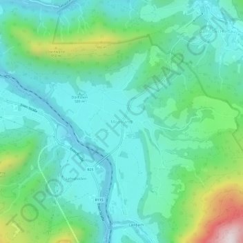
Name: Mooslandl topographic map, elevation, terrain.
Location: Mooslandl, Landl, Bezirk Liezen, Stiermarken, 8931, Oostenrijk (47.63299 14.74328 47.67299 14.78328)
Average elevation: 2,116 ft
Minimum elevation: 1,503 ft
Maximum elevation: 4,216 ft
Thank you for supporting this site ❤️
Make a donation
Make a donation
Gear up for your next adventure:
As an Amazon Associate, this site earns from qualifying purchases at no extra cost to you.
Other topographic maps
Click on a map to view its topography, its elevation and its terrain.