Geolocate

Ingham topographic map

Click on the map to display elevation.

About this map

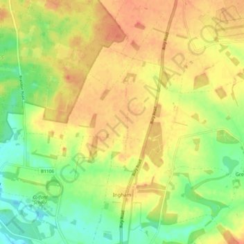
Name: Ingham topographic map, elevation, terrain.

Location: Ingham, West Suffolk, Suffolk, England, United Kingdom (52.29141 0.69829 52.34784 0.73845)

Average elevation: 141 ft

Minimum elevation: 59 ft

Maximum elevation: 207 ft

Other topographic maps

Click on a map to view its topography, its elevation and its terrain.

Exning

United Kingdom > England > Suffolk > West Suffolk

Average elevation: 75 ft

Gear up for your next adventure:

🔭Telescopic Hiking Pole - Adjustable pole for hiking stability
📻Weather Alert Radios - Stay informed of storm risks while off-the-grid
Camping Coffee Makers - Enjoy premium coffee at the summit or campsite
🎒Outdoor Daypacks - Lightweight backpacks designed for carrying maps and essential gear
🧭Hiking Compass - Precision compass for reliable navigation in the wilderness

As an Amazon Associate, this site earns from qualifying purchases at no extra cost to you.