Geolocate

Algonquin topographic map

Click on the map to display elevation.

About this map

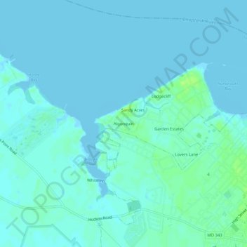
Name: Algonquin topographic map, elevation, terrain.

Location: Algonquin, Dorchester County, Maryland, 21613, United States (38.56290 -76.12577 38.60290 -76.08577)

Average elevation: 10 ft

Minimum elevation: -7 ft

Maximum elevation: 36 ft

Dorchester County trails, hiking, mountain biking, running and outdoor activities

Other topographic maps

Click on a map to view its topography, its elevation and its terrain.

Vienna

United States > Maryland > Dorchester County

Average elevation: 10 ft

Gear up for your next adventure:

🦶Carbon Trekking Poles - Reduce knee impact on steep descents with ultra-light poles
🚗GPS Dash Cams - Record your scenic drives through mountain passes and canyons
📡GPS Antenna Upgrade - Enhance GPS reception in remote terrain
🪑Portable Camp Table - Compact table for campsite meals
📦Dry Bags Set - Waterproof storage for electronics and clothes

As an Amazon Associate, this site earns from qualifying purchases at no extra cost to you.