Geolocate

Vienna topographic map

Click on the map to display elevation.

About this map

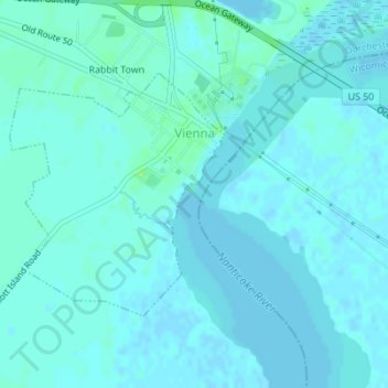
Name: Vienna topographic map, elevation, terrain.

Location: Vienna, Dorchester County, Maryland, United States (38.47211 -75.84111 38.48907 -75.82202)

Average elevation: 10 ft

Minimum elevation: -7 ft

Maximum elevation: 39 ft

Dorchester County trails, hiking, mountain biking, running and outdoor activities

Other topographic maps

Click on a map to view its topography, its elevation and its terrain.

Beulah

United States > Maryland > Dorchester County

Average elevation: 33 ft

Whitehall

United States > Maryland > Dorchester County

Average elevation: 13 ft

Linkwood

United States > Maryland > Dorchester County

Average elevation: 16 ft

Algonquin

United States > Maryland > Dorchester County

Average elevation: 10 ft

Gear up for your next adventure:

🧭GPS Watch Accessories - Bands and chargers for GPS watches
🪶Paracord Bracelet - Survival bracelet with built‑in tools
🗺️NatGeo Topo Maps - High-quality waterproof printed topographic maps of US Parks
🌧️Backpack Rain Cover - Keep gear dry in wet weather
🎒Gear Packing Cubes - Organize your backpack efficiently

As an Amazon Associate, this site earns from qualifying purchases at no extra cost to you.