
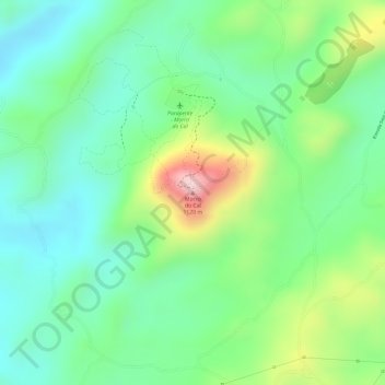
Morro do Cal topographic map
Click on the map to display elevation.
About this map
Name: Morro do Cal topographic map, elevation, terrain.
Average elevation: 3,054 ft
Minimum elevation: 2,723 ft
Maximum elevation: 3,704 ft
Other topographic maps
Click on a map to view its topography, its elevation and its terrain.
Três Córregos
Brasil > Paraná > Região Metropolitana de Curitiba > Campo Largo
Average elevation: 2,848 ft
Rio Verde
Brasil > Paraná > Região Metropolitana de Curitiba > Campo Largo
Average elevation: 3,012 ft
Parque Newton Puppi
Brasil > Paraná > Região Metropolitana de Curitiba > Campo Largo
Average elevation: 3,077 ft
Colônia Figueiredo
Brasil > Paraná > Região Metropolitana de Curitiba > Campo Largo
Average elevation: 3,120 ft