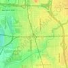
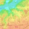
Indianapolis topographic map
Click on the map to display elevation.
Indianapolis
Between 2.6 million and 11,700 years ago, the Indianapolis area was situated on the southern margin of the Laurentide Ice Sheet. The erosive advance and retreat of glacial ice produced a flat or gently sloping landscape, known as a till plain. Elevations across Indianapolis vary from about 650 feet (198 m) to 900 feet (274 m) above mean sea level. Indianapolis is located in the West Fork White River drainage basin, part of the larger Mississippi River watershed via the Wabash and Ohio rivers. The White River flows 31 miles (50 km) north-to-south through the city and is fed by some 35 streams, including Eagle Creek, Fall Creek, Pleasant Run, and Pogue's Run. The city's largest waterbodies are artificial quarry lakes and reservoirs.
About this map

Name: Indianapolis topographic map, elevation, terrain.
Location: Indianapolis, Marion County, Indiana, United States (39.63216 -86.32812 39.92753 -85.93804)
Average elevation: 791 ft
Minimum elevation: 643 ft
Maximum elevation: 928 ft
Marion County trails, hiking, mountain biking, running and outdoor activities
Other topographic maps
Click on a map to view its topography, its elevation and its terrain.






Fort Benjamin Harrison State Park and Nature Preserve
United States > Indiana > Marion County > Indianapolis
Average elevation: 833 ft