
Arua Hill topographic map
Interactive map
Click on the map to display elevation.
About this map
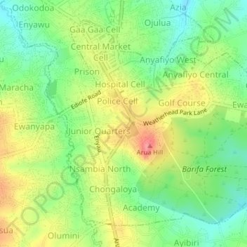
Name: Arua Hill topographic map, elevation, terrain.
Location: Arua Hill, Arua, Northern Region, 481, Ouganda (3.00068 30.90511 3.02718 30.93714)
Average elevation: 3,950 ft
Minimum elevation: 3,832 ft
Maximum elevation: 4,094 ft
Other topographic maps
Click on a map to view its topography, its elevation and its terrain.