
Onialeku topographic map
Interactive map
Click on the map to display elevation.
About this map
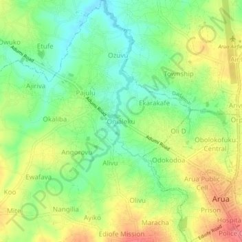
Name: Onialeku topographic map, elevation, terrain.
Location: Onialeku, Pajulu, Arua, Northern Region, Ouganda (3.01535 30.87393 3.05535 30.91393)
Average elevation: 3,894 ft
Minimum elevation: 3,789 ft
Maximum elevation: 4,019 ft
Other topographic maps
Click on a map to view its topography, its elevation and its terrain.