Geolocate

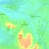
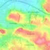
Ashcott topographic map

Click on the map to display elevation.

About this map

Name: Ashcott topographic map, elevation, terrain.

Location: Ashcott, Somerset, England, United Kingdom (51.10199 -2.84907 51.15539 -2.78555)

Average elevation: 72 ft

Minimum elevation: -10 ft

Maximum elevation: 305 ft

Other topographic maps

Click on a map to view its topography, its elevation and its terrain.
Chard

United Kingdom > England > Somerset

Chard is a town and a civil parish in the English county of Somerset. It lies on the A30 road near the Devon and Dorset borders, 15 miles (24 km) south west of Yeovil. The parish has a population of approximately 14,000 and, at an elevation of 121 metres (397 ft), Chard is the southernmost and one of the…

Average elevation: 443 ft
Charlton Mackrell

United Kingdom > England > Somerset

Average elevation: 138 ft

Ashington

United Kingdom > England > Somerset

Average elevation: 82 ft

Bird Pond

United Kingdom > England > Somerset > Brompton Regis > Hartford

Average elevation: 830 ft

Aller

United Kingdom > England > Somerset > South Somerset

Average elevation: 92 ft

Shurton

United Kingdom > England > Somerset > Stogursey

Average elevation: 85 ft

Knott Oak

United Kingdom > England > Somerset > Ilminster

Average elevation: 210 ft

Low Ham

United Kingdom > England > Somerset > High Ham

Average elevation: 148 ft

Sutton

United Kingdom > England > Somerset > Alhampton

Average elevation: 154 ft

Gear up for your next adventure:

🪶Thermal Camp Blanket - Extra warmth for cold nights
🪓Survival Multi‑Tool - Versatile tool for camp and trail tasks
⌚Solar GPS Watches - Advanced multisport watches with built-in topographic maps
🩹Survival Bandages - High‑quality bandages for emergencies
🪑Ultralight Camp Chairs - Portable seating for resting after a long day of mapping

As an Amazon Associate, this site earns from qualifying purchases at no extra cost to you.