
Thank you for supporting this site ❤️
Make a donation
Make a donation
Gear up for your next adventure:
As an Amazon Associate, this site earns from qualifying purchases at no extra cost to you.
Kutus topographic map
Click on the map to display elevation.
Thank you for supporting this site ❤️
Make a donation
Make a donation
Gear up for your next adventure:
As an Amazon Associate, this site earns from qualifying purchases at no extra cost to you.
About this map
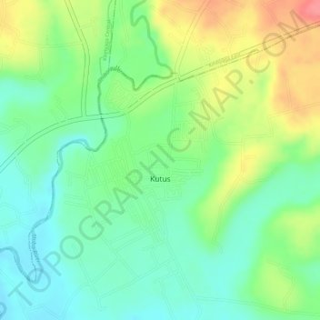
Name: Kutus topographic map, elevation, terrain.
Location: Kutus, Mwea East, Kirinyaga County, Central Kenya, Kenya (-0.58056 37.31754 -0.56251 37.33263)
Average elevation: 4,216 ft
Minimum elevation: 4,104 ft
Maximum elevation: 4,383 ft
Thank you for supporting this site ❤️
Make a donation
Make a donation
Gear up for your next adventure:
As an Amazon Associate, this site earns from qualifying purchases at no extra cost to you.