
Qu'Appelle topographic map
Click on the map to display elevation.
Qu'Appelle
Qu'Appelle is located in the Indian Head Plain of the Aspen Parkland ecoregion on the parkland of the Qu'Appelle flood plain. Qu'Appelle's elevation is 662.90 m (2,174.9 ft) above sea level. The area is characterised by lush rolling grasslands, interspersed with poplar bluffs (in prairie Canadian terminology poplar groves surrounding sloughs) and open sloughs. Qu'Appelle is located in the transition zone between the Qu'Appelle River and the corresponding Qu'Appelle Valley and the Canadian Prairies.
About this map
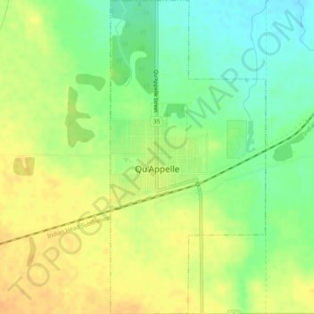
Name: Qu'Appelle topographic map, elevation, terrain.
Location: Qu'Appelle, Division No. 6, Saskatchewan, S0G 4A0, Canada (50.52776 -103.88483 50.55699 -103.86206)
Average elevation: 2,136 ft
Minimum elevation: 2,077 ft
Maximum elevation: 2,182 ft