
Acton topographic map
Click on the map to display elevation.
About this map
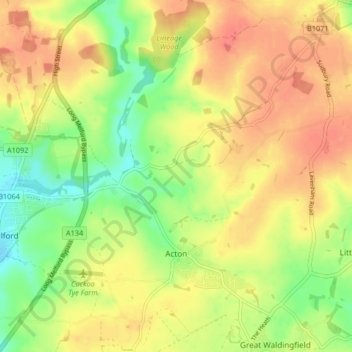
Name: Acton topographic map, elevation, terrain.
Location: Acton, Babergh, Suffolk, England, United Kingdom (52.05692 0.73489 52.10745 0.78661)
Average elevation: 210 ft
Minimum elevation: 108 ft
Maximum elevation: 295 ft
Other topographic maps
Click on a map to view its topography, its elevation and its terrain.
Constable 'The Haywain' viewing point
United Kingdom > England > Suffolk > Babergh > East Bergholt > Flatford
Average elevation: 49 ft
Almshouse Green
United Kingdom > England > Suffolk > Babergh > Thorpe Morieux
Average elevation: 266 ft
Mill Green
United Kingdom > England > Suffolk > Babergh > Edwardstone > Mill Green
Average elevation: 194 ft
Flatford
United Kingdom > England > Suffolk > Babergh > East Bergholt > Flatford
Average elevation: 72 ft
Long Melford-Bury St Edmunds branch line
United Kingdom > England > Suffolk > Babergh > Lavenham
Average elevation: 230 ft