
Río Marcala topographic map
Interactive map
Click on the map to display elevation.
About this map
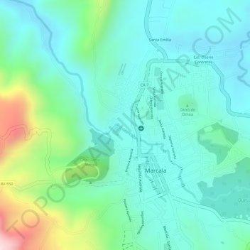
Name: Río Marcala topographic map, elevation, terrain.
Location: Río Marcala, La Paz, Honduras (14.15413 -88.04336 14.16498 -88.03183)
Average elevation: 4,229 ft
Minimum elevation: 3,911 ft
Maximum elevation: 5,164 ft
Other topographic maps
Click on a map to view its topography, its elevation and its terrain.