
Marcala topographic map
Interactive map
Click on the map to display elevation.
About this map
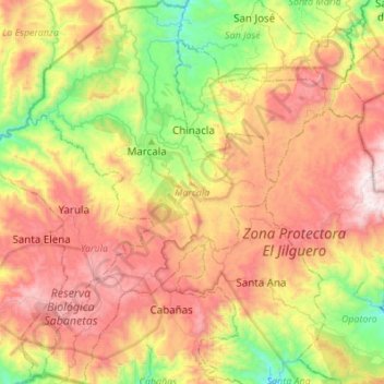
Name: Marcala topographic map, elevation, terrain.
Location: Marcala, La Paz, Honduras (13.99410 -88.11843 14.25860 -87.94309)
Average elevation: 5,007 ft
Minimum elevation: 3,068 ft
Maximum elevation: 7,156 ft
Other topographic maps
Click on a map to view its topography, its elevation and its terrain.