
Maple Ridge topographic map
Click on the map to display elevation.
About this map
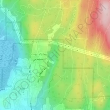
Name: Maple Ridge topographic map, elevation, terrain.
Average elevation: 420 ft
Minimum elevation: 7 ft
Maximum elevation: 1,063 ft
Other topographic maps
Click on a map to view its topography, its elevation and its terrain.
Port Coquitlam
Canada > British Columbia > Metro Vancouver Regional District > Port Coquitlam
Average elevation: 607 ft
West End
Canada > British Columbia > Metro Vancouver Regional District > Vancouver
Average elevation: 49 ft
Tsawwassen First Nation
Canada > British Columbia > Metro Vancouver Regional District
Average elevation: 16 ft
Fairview
Canada > British Columbia > Metro Vancouver Regional District > Vancouver
Average elevation: 105 ft
New Westminster
Canada > British Columbia > Metro Vancouver Regional District
Average elevation: 285 ft
Coquitlam Watershed
Canada > British Columbia > Metro Vancouver Regional District > Electoral Area A
Average elevation: 2,208 ft
Cliff Falls
Canada > British Columbia > Metro Vancouver Regional District > Maple Ridge
Average elevation: 348 ft
Black Mountain (South Summit)
Canada > British Columbia > Metro Vancouver Regional District > West Vancouver
Average elevation: 3,071 ft
Kitsilano
Canada > British Columbia > Metro Vancouver Regional District > Vancouver
Average elevation: 79 ft
Victoria-Fraserview
Canada > British Columbia > Metro Vancouver Regional District > Vancouver
Average elevation: 236 ft
The West Lion
Canada > British Columbia > Metro Vancouver Regional District > Electoral Area A
Hikers can climb up to the ridge between the East and West Lion peaks using either the Binkert Trail leading up from Lions Bay, or the Howe Sound Crest Trail. The Binkert Trail, named after Paul Binkert of the British Columbia Mountaineering Club, is one of the most popular in the Lower Mainland. Hiking to the…
Average elevation: 3,802 ft
Surrey
Canada > British Columbia > Metro Vancouver Regional District > Surrey
Average elevation: 213 ft
Coquitlam
Canada > British Columbia > Metro Vancouver Regional District > Coquitlam
Southwest Coquitlam comprises the original core of the city, with Maillardville and Fraser River industrial sector giving way to the large residential areas of Austin Heights, colloquially referred to as "The Bump" due to its high and flat plateau topography. These older residences, with larger property…
Average elevation: 755 ft
Metro Vancouver Regional Parks
Canada > British Columbia > Metro Vancouver Regional District > Electoral Area A
Average elevation: 627 ft