
Make a donation
Gear up for your next adventure:
As an Amazon Associate, this site earns from qualifying purchases at no extra cost to you.
South Pass topographic map
Click on the map to display elevation.
Make a donation
Gear up for your next adventure:
As an Amazon Associate, this site earns from qualifying purchases at no extra cost to you.
About this map
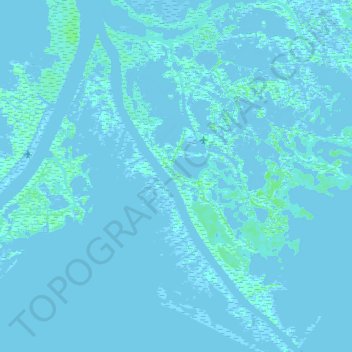
Name: South Pass topographic map, elevation, terrain.
Location: South Pass, Plaquemines Parish, Louisiana, United States (29.00239 -89.25381 29.15784 -89.15032)
Average elevation: 0 ft
Minimum elevation: -16 ft
Maximum elevation: 23 ft
Make a donation
Gear up for your next adventure:
As an Amazon Associate, this site earns from qualifying purchases at no extra cost to you.
Other topographic maps
Click on a map to view its topography, its elevation and its terrain.
Empire
United States > Louisiana > Plaquemines Parish
Empire is located at 29°23′55″N 89°36′31″W / 29.39861°N 89.60861°W / 29.39861; -89.60861 (29.398586, -89.608501) and has an elevation of 3 feet (0.9 m).
Average elevation: 3 ft
Make a donation
Gear up for your next adventure:
As an Amazon Associate, this site earns from qualifying purchases at no extra cost to you.
Make a donation
Gear up for your next adventure:
As an Amazon Associate, this site earns from qualifying purchases at no extra cost to you.