
Nacaome topographic map
Interactive map
Click on the map to display elevation.
About this map
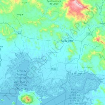
Name: Nacaome topographic map, elevation, terrain.
Location: Nacaome, Valle, Honduras (13.31494 -87.65051 13.66962 -87.36727)
Average elevation: 308 ft
Minimum elevation: -3 ft
Maximum elevation: 3,182 ft
Other topographic maps
Click on a map to view its topography, its elevation and its terrain.