Geolocate

Merrill topographic map

Click on the map to display elevation.

About this map
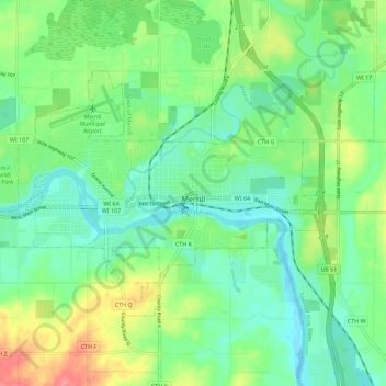
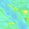
Name: Merrill topographic map, elevation, terrain.

Location: Merrill, Lincoln County, Wisconsin, United States (45.15669 -89.75895 45.20666 -89.64733)

Average elevation: 1,306 ft

Minimum elevation: 1,227 ft

Maximum elevation: 1,473 ft

Lincoln County trails, hiking, mountain biking, running and outdoor activities

Other topographic maps

Click on a map to view its topography, its elevation and its terrain.
Chicago Island

United States > Wisconsin > Lincoln County > Tomahawk

Average elevation: 1,447 ft

Irma

United States > Wisconsin > Lincoln County

Average elevation: 1,526 ft

Gleason

United States > Wisconsin > Lincoln County > Town of Russell

Average elevation: 1,460 ft

Dudley

United States > Wisconsin > Lincoln County

Average elevation: 1,516 ft

Gear up for your next adventure:

🛠️Backpacking Tool Kit - Essential toolkit for outdoor repairs
🧭Pro Hiking Compasses - High-accuracy liquid-filled compasses for topographic orientation
🧤Hiking Gloves - Protective gloves for rugged trails
🔥Camping Stove - Portable stove for camping and backcountry cooking
🌡️Portable Weather Meter - Track weather conditions on the trail

As an Amazon Associate, this site earns from qualifying purchases at no extra cost to you.