
Merrill topographic map
Click on the map to display elevation.
About this map
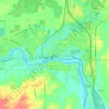
Name: Merrill topographic map, elevation, terrain.
Location: Merrill, Lincoln County, Wisconsin, United States (45.15669 -89.75895 45.20666 -89.64733)
Average elevation: 1,306 ft
Minimum elevation: 1,227 ft
Maximum elevation: 1,473 ft
Lincoln County trails, hiking, mountain biking, running and outdoor activities
Other topographic maps
Click on a map to view its topography, its elevation and its terrain.