
Irma topographic map
Click on the map to display elevation.
About this map
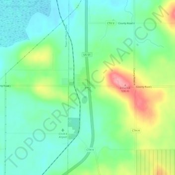
Name: Irma topographic map, elevation, terrain.
Average elevation: 1,526 ft
Minimum elevation: 1,414 ft
Maximum elevation: 1,759 ft
Lincoln County trails, hiking, mountain biking, running and outdoor activities
Other topographic maps
Click on a map to view its topography, its elevation and its terrain.
Seven Island Lake
United States > Wisconsin > Lincoln County > Town of Harrison
Average elevation: 1,785 ft