Geolocate

Prescott topographic map

Click on the map to display elevation.

About this map
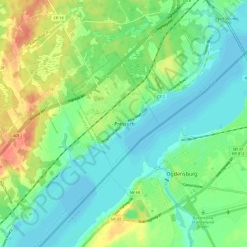
Name: Prescott topographic map, elevation, terrain.

Location: Prescott, Eastern Ontario, Ontario, K0E 1T0, Canada (44.67042 -75.55290 44.75042 -75.47290)

Average elevation: 292 ft

Minimum elevation: 236 ft

Maximum elevation: 397 ft

Gear up for your next adventure:

🧦Hiking Socks - Comfortable socks to prevent blisters on long hikes
🥾Men's Hiking Boots - Durable, waterproof footwear for rugged terrain and steep inclines
🧭Compass with Lanyard - Easy‑carry compass for navigation
🚁Photography Drones - Capture stunning aerial views of landforms and topography
⛺Backpacking Tents - Weight-optimized shelters for multi-day topographic surveys

As an Amazon Associate, this site earns from qualifying purchases at no extra cost to you.