
Mandeville topographic map
Click on the map to display elevation.
Mandeville
Mandeville is located at 30°22′9″N 90°4′41″W / 30.36917°N 90.07806°W / 30.36917; -90.07806 (30.369282, -90.078006), and has an elevation of 7 feet (2.1 m). According to the United States Census Bureau, the city has a total area of 6.8 square miles (17.7 km2), of which 0.12 square miles (0.3 km2), or 1.55%, is covered by water. The Tchefuncte River flows through Madisonville, where a human operated swing bridge still connects suburban Mandeville to Madisonville.
About this map
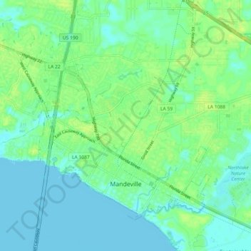
Name: Mandeville topographic map, elevation, terrain.
Location: Mandeville, St. Tammany Parish, Louisiana, United States (30.34835 -90.12555 30.40426 -90.03525)
Average elevation: 20 ft
Minimum elevation: -10 ft
Maximum elevation: 46 ft
St. Tammany Parish trails, hiking, mountain biking, running and outdoor activities
Other topographic maps
Click on a map to view its topography, its elevation and its terrain.