
Thank you for supporting this site ❤️
Make a donation
Make a donation
Gear up for your next adventure:
As an Amazon Associate, this site earns from qualifying purchases at no extra cost to you.
Sorel-Tracy topographic map
Click on the map to display elevation.
Thank you for supporting this site ❤️
Make a donation
Make a donation
Gear up for your next adventure:
As an Amazon Associate, this site earns from qualifying purchases at no extra cost to you.
About this map
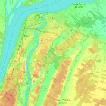
Name: Sorel-Tracy topographic map, elevation, terrain.
Location: Sorel-Tracy, Pierre-De Saurel, Montérégie, Quebec, Canada (45.95517 -73.18115 46.05155 -73.01084)
Average elevation: 49 ft
Minimum elevation: 0 ft
Maximum elevation: 108 ft
Thank you for supporting this site ❤️
Make a donation
Make a donation
Gear up for your next adventure:
As an Amazon Associate, this site earns from qualifying purchases at no extra cost to you.