Geolocate

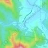
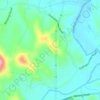
Ashmore topographic map

Click on the map to display elevation.

About this map

Name: Ashmore topographic map, elevation, terrain.

Location: Ashmore, Gold Coast, Queensland, Australia (-28.00019 153.34103 -27.97600 153.40110)

Average elevation: 56 ft

Minimum elevation: -10 ft

Maximum elevation: 243 ft

Other topographic maps

Click on a map to view its topography, its elevation and its terrain.
Pimpama

Australia > Queensland > Gold Coast > Pimpama

Average elevation: 62 ft

Reedy Creek

Australia > Queensland > Gold Coast

Average elevation: 52 ft

Maudsland

Australia > Queensland > Gold Coast

Average elevation: 141 ft

Lower Beechmont

Australia > Queensland > Gold Coast

Average elevation: 974 ft

Clagiraba

Australia > Queensland > Gold Coast

Average elevation: 400 ft

Binna Burra

Australia > Queensland > Gold Coast

Average elevation: 1,755 ft

Guanaba

Australia > Queensland > Gold Coast

Average elevation: 167 ft

Austinville

Australia > Queensland > Gold Coast

Average elevation: 479 ft

Anglers Paradise

Australia > Queensland > Gold Coast

Average elevation: 7 ft

Gear up for your next adventure:

🪶Wildlife Field Guides - Learn animal tracking and species ID
🎒Outdoor Daypacks - Lightweight backpacks designed for carrying maps and essential gear
🪶Camp Gear Gift Set - Perfect gift bundle for outdoor fans
🥾Hiking Shoes - Durable and comfortable shoes for trail hiking
📌Outdoor GPS Map App - Apps and devices for digital topographic navigation

As an Amazon Associate, this site earns from qualifying purchases at no extra cost to you.