Geolocate

Lorimer Lake topographic map

Click on the map to display elevation.

About this map

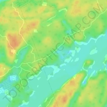
Name: Lorimer Lake topographic map, elevation, terrain.

Location: Lorimer Lake, Whitestone, Parry Sound District, Central Ontario, Ontario, Canada (45.53631 -79.98459 45.55631 -79.96459)

Average elevation: 840 ft

Minimum elevation: 787 ft

Maximum elevation: 896 ft

Other topographic maps

Click on a map to view its topography, its elevation and its terrain.

Bolger Lake

Canada > Ontario > Parry Sound District > Whitestone

Average elevation: 778 ft

Gear up for your next adventure:

🧭Hiking Compass - Precision compass for reliable navigation in the wilderness
🥘Titanium Cookware - Durable, featherlight pots and pans for backpacking
🪶Camp Gear Gift Set - Perfect gift bundle for outdoor fans
🔥Plasma Lighters - Windproof lighters that work in any weather condition
🦺Reflective Outdoor Gear - Safety gear for low‑light conditions

As an Amazon Associate, this site earns from qualifying purchases at no extra cost to you.