Geolocate

Shelburne topographic map

Click on the map to display elevation.

About this map

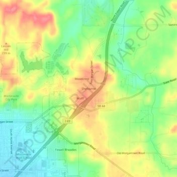
Name: Shelburne topographic map, elevation, terrain.

Location: Shelburne, Morgan County, Indiana, 46151, United States (39.41533 -86.41277 39.45533 -86.37277)

Average elevation: 722 ft

Minimum elevation: 607 ft

Maximum elevation: 846 ft

Morgan County trails, hiking, mountain biking, running and outdoor activities

Other topographic maps

Click on a map to view its topography, its elevation and its terrain.

Martinsville

United States > Indiana > Morgan County

Average elevation: 646 ft

Brooklyn

United States > Indiana > Morgan County

Average elevation: 676 ft

Paragon

United States > Indiana > Morgan County

Average elevation: 577 ft

Mooresville

United States > Indiana > Morgan County

Average elevation: 732 ft

Mooresville

United States > Indiana > Morgan County

Average elevation: 732 ft

Martinsville

United States > Indiana > Morgan County

Average elevation: 646 ft

Gear up for your next adventure:

🏫Relief Map Kits - Hands-on tools for teaching landforms and elevation
🧦Merino Wool Socks - Moisture-wicking, blister-preventing socks for long treks
🔥Plasma Lighters - Windproof lighters that work in any weather condition
🪶LED Camping Lantern - Bright lantern for camp lighting
🪶Compact Camp Shovel - Folding shovel for campsite tasks

As an Amazon Associate, this site earns from qualifying purchases at no extra cost to you.