Geolocate

Brooklyn topographic map

Click on the map to display elevation.

About this map

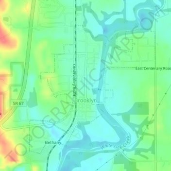
Name: Brooklyn topographic map, elevation, terrain.

Location: Brooklyn, Morgan County, Indiana, 46111, United States (39.53196 -86.37838 39.55106 -86.35491)

Average elevation: 676 ft

Minimum elevation: 617 ft

Maximum elevation: 810 ft

Morgan County trails, hiking, mountain biking, running and outdoor activities

Other topographic maps

Click on a map to view its topography, its elevation and its terrain.

Shelburne

United States > Indiana > Morgan County

Average elevation: 722 ft

Gear up for your next adventure:

🏥Hiking First Aid Kits - Comprehensive medical kits for remote trail injuries
🔋Solar Power Banks - Keep your GPS and phone charged in remote wilderness areas
🩹Survival Bandages - High‑quality bandages for emergencies
🔦Compact Flashlight - Reliable flashlight for emergencies
🧢Outdoor Hiking Hat - Sun protection hat for outdoor explorers

As an Amazon Associate, this site earns from qualifying purchases at no extra cost to you.