Geolocate

Kafuro topographic map

Click on the map to display elevation.

About this map

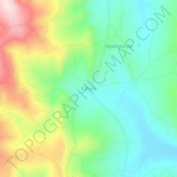
Name: Kafuro topographic map, elevation, terrain.

Location: Kafuro, Karagwe, Kagera, Lake Zone, Tanzania (-1.74186 30.97276 -1.70186 31.01276)

Average elevation: 4,767 ft

Minimum elevation: 4,298 ft

Maximum elevation: 5,643 ft

Other topographic maps

Click on a map to view its topography, its elevation and its terrain.

Muleba

Tanzania > Kagera

Average elevation: 4,121 ft

Bukoba

Tanzania > Kagera

Average elevation: 3,990 ft

Karagwe

Tanzania > Kagera

Average elevation: 4,442 ft

Kibeta

Tanzania > Kagera

Average elevation: 4,137 ft

Karagwe

Tanzania > Kagera

Average elevation: 4,442 ft

Karagwe

Tanzania > Kagera

Average elevation: 4,442 ft

Gear up for your next adventure:

🔥Fast-Boil Camping Stoves - Efficient cooking systems for quick trail meals
📡Handheld GPS Device - Reliable handheld GPS for outdoor navigation
🏥Hiking First Aid Kits - Comprehensive medical kits for remote trail injuries
🎒Gear Packing Cubes - Organize your backpack efficiently
📌Outdoor GPS Map App - Apps and devices for digital topographic navigation

As an Amazon Associate, this site earns from qualifying purchases at no extra cost to you.