
蕉岭县 topographic map
Interactive map
Click on the map to display elevation.
About this map
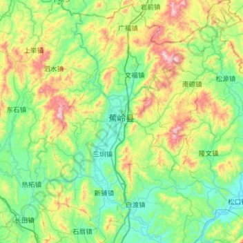
Name: 蕉岭县 topographic map, elevation, terrain.
Location: 蕉岭县, 梅州市, 广东省, 中国 (24.42479 116.01902 24.88076 116.41298)
Average elevation: 1,079 ft
Minimum elevation: 174 ft
Maximum elevation: 3,665 ft
Other topographic maps
Click on a map to view its topography, its elevation and its terrain.