
Black topographic map
Click on the map to display elevation.
About this map
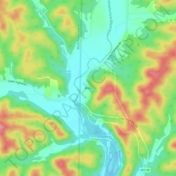
Name: Black topographic map, elevation, terrain.
Location: Black, Reynolds County, Missouri, United States (37.51144 -90.95318 37.55144 -90.91318)
Average elevation: 883 ft
Minimum elevation: 728 ft
Maximum elevation: 1,125 ft
Reynolds County trails, hiking, mountain biking, running and outdoor activities
Other topographic maps
Click on a map to view its topography, its elevation and its terrain.
Current River Conservation Area
United States > Missouri > Reynolds County > Ellington
Average elevation: 820 ft