
Worthington Hills topographic map
Interactive map
Click on the map to display elevation.
About this map
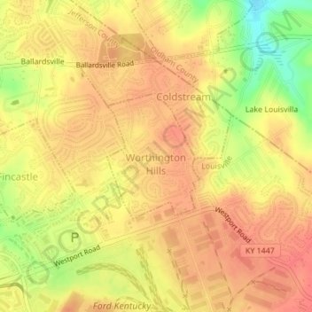
Name: Worthington Hills topographic map, elevation, terrain.
Location: Worthington Hills, Jefferson County, Kentucky, United States (38.30420 -85.53233 38.31509 -85.52202)
Average elevation: 725 ft
Minimum elevation: 600 ft
Maximum elevation: 781 ft
Jefferson County trails, hiking, mountain biking, running and outdoor activities
Other topographic maps
Click on a map to view its topography, its elevation and its terrain.
Jefferson Memorial Forest
United States > Kentucky > Jefferson County > Louisville
Average elevation: 538 ft
Louisville-Jefferson County (Balance)
United States > Kentucky > Jefferson County > Louisville
Average elevation: 515 ft
Falls of the Ohio State Park
United States > Kentucky > Jefferson County > Louisville
Average elevation: 443 ft
Bellewood
United States > Kentucky > Jefferson County > St. Matthews > Bellewood
Average elevation: 548 ft