Geolocate

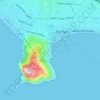
Güzelbağ topographic map

Click on the map to display elevation.

About this map

Name: Güzelbağ topographic map, elevation, terrain.

Location: Güzelbağ, Alanya, Antalya, Mediterranean Region, Turkey (36.71248 31.87718 36.75248 31.91718)

Average elevation: 3,012 ft

Minimum elevation: 1,913 ft

Maximum elevation: 3,996 ft

Other topographic maps

Click on a map to view its topography, its elevation and its terrain.

Tosmur

Turkey > Alanya

Average elevation: 43 ft

Cikcilli

Turkey > Alanya

Average elevation: 315 ft

Çarşı Mahallesi

Turkey > Alanya

Average elevation: 66 ft

Çarşı Mahallesi

Turkey > Alanya

Average elevation: 62 ft

Tophane Mahallesi

Turkey > Alanya

Average elevation: 56 ft

Gear up for your next adventure:

🧤Tactile Hiking Gloves - Keep hands warm while operating GPS and smartphone screens
🎒Trekking Poles - Sturdy poles for balance and stability on rough terrain
🚑Emergency Bivvies - Heat-reflective sleeping bags for survival situations
⛺Backpacking Tent - Lightweight and durable tent for multi‑day hikes
🛏️Cold Weather Sleeping Bag - Warm sleeping bag for cold conditions

As an Amazon Associate, this site earns from qualifying purchases at no extra cost to you.