Geolocate

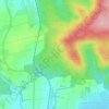
Nidda topographic map

Click on the map to display elevation.

About this map

Name: Nidda topographic map, elevation, terrain.

Location: Nidda, Wetteraukreis, Hesse, 63667, Germany (50.38754 8.97620 50.43091 9.04001)

Average elevation: 591 ft

Minimum elevation: 413 ft

Maximum elevation: 1,070 ft

Other topographic maps

Click on a map to view its topography, its elevation and its terrain.

Der Haag

Germany > Hesse > Wetteraukreis > Melbach

Average elevation: 509 ft

Kreischberg

Germany > Hesse > Wetteraukreis > Büdingen

Average elevation: 699 ft

Gear up for your next adventure:

🧯Emergency Survival Kit - All‑in‑one survival essentials for the backcountry
👟Men's Trail Runners - Lightweight footwear for fast-paced exploration and light hiking
🥾Women's Hiking Boots - Top-rated trail boots with ankle support and superior grip
🌡️Portable Weather Meter - Track weather conditions on the trail
🔭Stargazing Telescopes - Perfect for camping in low-light pollution areas shown on maps

As an Amazon Associate, this site earns from qualifying purchases at no extra cost to you.